
- Ingrid Lu | Staff
- Aug 12, 2026 (DailyCal.org)
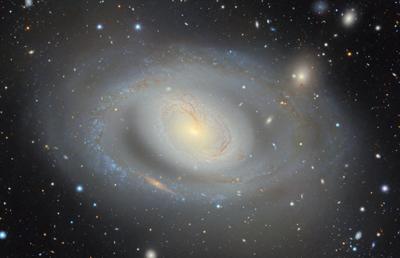
DESI Legacy Imaging Surveys, assisted by researchers from Lawrence Berkeley National Laboratory, produced the world’s largest 2D color map of the universe. The map contains almost 4 billion celestial objects.
The project has been in development for 13 years, during which the team at Legacy Surveys released 10 datasets before the map reached its current and largest form. The latest and 11th data release expands the map to 5.6 trillion pixels.
The map combines more than 260,000 telescope exposures from three different sky surveys: the Beijing-Arizona Sky Survey, the Dark Energy Camera Legacy Survey and the Mayall z-band Legacy Survey. The data was collected by more than 160 scientists.
According to project co-lead David Schlegel, a senior physicist at Berkeley Lab, the project began in 2013 in the interest of studying dark energy.
In studying dark energy, researchers were required to know where the Dark Energy Spectroscopic Instrument should be directed. The team set out to create a 3D map of the universe and its observable objects. The 3D model — of which the team has published smaller iterations since — needed a 2D map to serve as a foundation.
“We had just started collecting data. Our analysis was just being developed,” Schlegel said. “So while we’ve been accumulating data over all these years, we’ve also been accumulating knowledge and our sophistication of those images as well.”
Schlegel said the newest version of the map encompasses the entire extragalactic sky, which is the expanse of sky not blocked by the Milky Way.
Dustin Lang, a DESI Imaging Survey scientist, helped build code used in the project that reconciles information across images of different qualities. The computer is then able to predict the appearance of stars and galaxies above the atmosphere by compositing and comparing the blurriness across multiple images of each portion of the sky.
Different iterations of the data from DESI Legacy Imaging Surveys have been referenced in more than 1,800 published scientific papers. Schlegel said undergraduates at UC Berkeley have not only participated in the project but used the map in their own research — including using it as a reference to discover rare gravitational lensing systems.
Schlegel met his project co-lead Arjun Dey when they were both graduate students at UC Berkeley. Dey was the first person to take Schlegel to see a telescope, which pulled Schlegel into the world of observational astronomy.
Schlegel said seeing all of the research initiatives that use DESI Legacy Imaging Surveys’ data has given him a “warm fuzzy feeling.”
“We’ve gotten what we need out of the data,” Schlegel said. “But then every day I see in the literature other researchers making use of the data, and it’s a validation every day.”