
Amy Graff, SFGATE
Nov. 28, 2022Updated: Nov. 28, 2022 3:33 p.m.
Lava flows on Mauna Loa moving in ‘best possible direction,’ mayor says
Nov. 28, 3:33 p.m.
Mitch Roth, the mayor of Hawaii County, said Monday that the lava flows on Mauna Loa were flowing in a direction that is not threatening to communities near the volcano.
Read More
Pahala, Naalehu, Ocean View, Milolii, Napoopoo, Captain Cook, Kealakekua and Keauhou — areas in the southwestern rift zone that are at high risk in the event of a major eruption — were not threatened as of Monday afternoon, Roth said in a news release issued at noon local time.
“Our team is on full alert and is prepared to respond to whatever situation may arise as a result of the Mauna Loa eruption,” Roth said. “That said, we’ve been told that the lava is heading in the best possible direction, which is away from our communities. We’ll continue to monitor the situation and will be providing updates to the community regularly. Until then, we thank our State and County partners, departments, and agencies for their quick action and attention to every detail.”
The release from the mayor’s office said that while scientists are monitoring the eruption that began Sunday, it remains unknown how long the event will last and how much lava will flow from the volcano.
No evacuations were in place as of Monday afternoon. Shelters were opened in Kau at the Robert Herkes Gymnasium and the Old Airport Gym in Kailua-Kona, due to people self-evacuating out of caution, the mayor’s office said.
No road closures are in place except the Mauna Loa Access Road, which was shut down to traffic early this morning.
Officials release map with vog forecast amid Mauna Loa eruption
Nov. 28, 2:23 p.m.
Officials released a forecast model Monday showing the dispersion of volcanic emissions, also known as vog, on the Big Island of Hawaii and their impacts on air quality levels amid Mauna Loa’s eruption.
The forecast said there were moderate levels of emissions — sulfur dioxide and sulfate aerosols — on Monday.
The VMAP Vog Forecast Dashboard is intended to identify areas of possible health risks for the general public under standards set by the Environmental Protection Agency, the U.S. Geological Survey, which is monitoring the eruption, said on Twitter.
The USGS reiterated on Monday afternoon that lava flows are not threatening downslope communities amid the eruption.
Get the latest information on the eruption from the USGS website.
Southwest cancels some Hawaii flights as Mauna Loa eruption spews ash
Nov. 28, 1 p.m.
Southwest Airlines has suspended operations at Hilo International Airport due to Mauna Loa on the Big Island of Hawaii erupting late Sunday. The temporary suspension resulted in the cancellation of 10 interisland departures. Southwest operates five round-trip flights a day between Hilo International Airport and Daniel K. Inouye International Airport in Honolulu. Get more details on how travel in Hawaii is being impacted by the volcano at SFGATE.
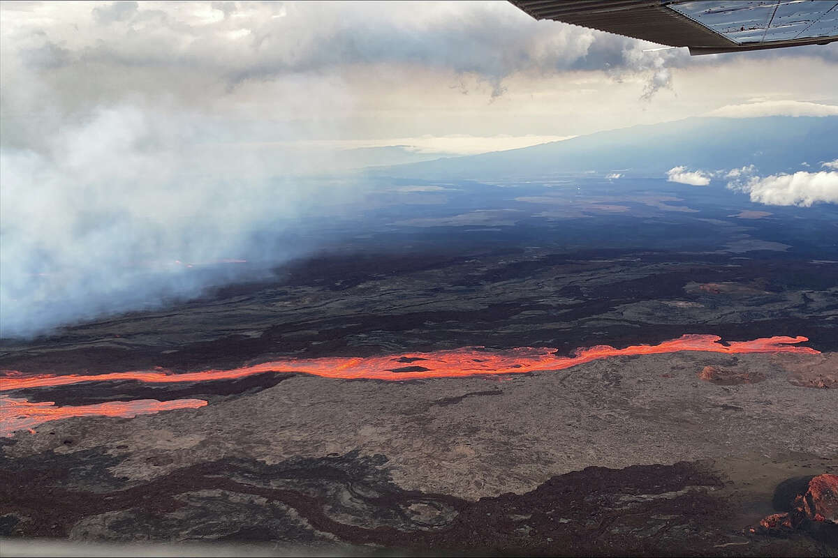
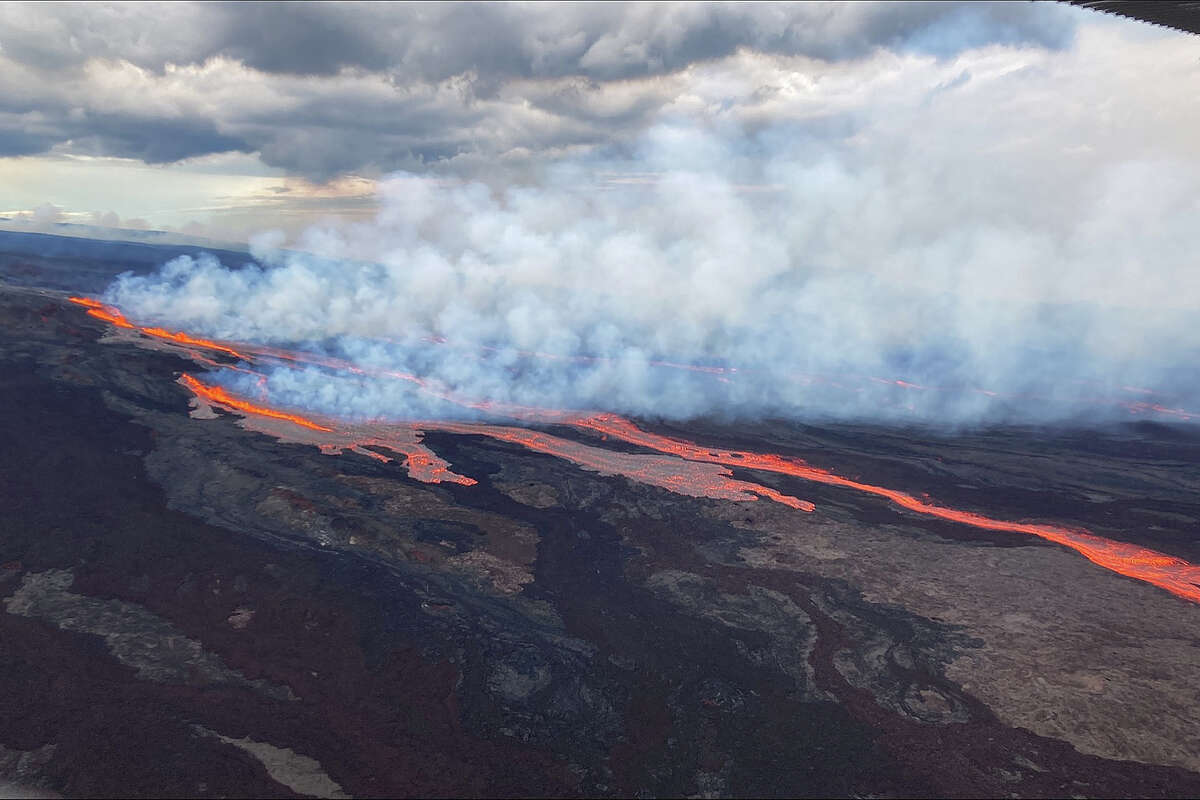
Officials release images of lava flows at Hawaii’s Mauna Loa
Nov. 28, 11:15 a.m.
Officials released images on Monday of the lava flows on Mauna Loa, a volcano on the Big Island of Hawaii. The world’s most active volcano started erupting for the first time in nearly four decades on Sunday night.
The images show the volcano erupting from vents on the northeast rift zone. “Flows are moving downslope to the north,” the U.S. Geological Society said.
As of 11:02 a.m., the USGS said lava flows were not threatening downslope communities.
The agency said crews were on-site this morning collecting information to create lava flow forecasts to identify potential hazards.
The National Weather Service announced at 11 a.m. that an ash advisory had been canceled but warned that people with respiratory illness should be aware of “the potential for areas of low air quality due to vog,” which occurs when volcano emissions are mixed with fog.
#MaunaLoa is erupting from vents on the Northeast Rift zone. Flows are moving downslope to the north. USGS Photos from Civil Air Patrol fight. #MaunaLoaErupts @Volcanoes_NPS @Hawaii_EMA @CivilDefenseHI pic.twitter.com/kUYWYPdk4L
— USGS Volcanoes? (@USGSVolcanoes) November 28, 2022
Hawaii issues travel advisory for two airports on Big Island as Mauna Loa erupts
Nov. 28, 10:40 a.m.
The Hawaii Department of Transportation issued a travel advisory on Monday morning for two airports on the Big Island, where the Mauna Loa volcano is erupting.
“Passengers with flights to Hilo International Airport (ITO) or the Ellison Onizuka Kona International Airport at Keahole (KOA) should check with their airline prior to heading to the airport due to the volcanic activity at Mauna Loa,” the department said via Twitter.
Lava flows from Hawaii’s Mauna Loa are not threatening communities
Nov. 28, 10:25 a.m.
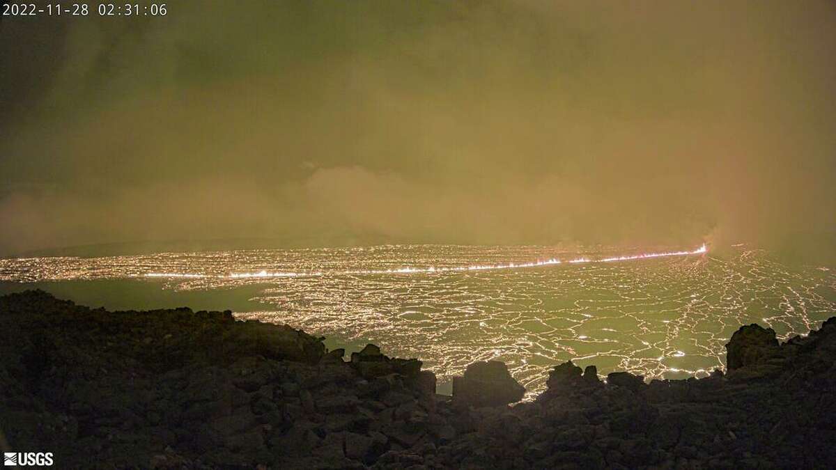
The eruption of Hawaii‘s Mauna Loa volcano shifted from the summit caldera to the northeast rift zone, with fissures feeding several lava flows, the U.S. Geological Survey said at 7:20 a.m. local time.
“Lava flows are not threatening any downslope communities and all indications are that the eruption will remain in the Northeast Rift Zone,” the USGS said in its update. “Volcanic gas and possibly fine ash and Pele’s Hair may be carried downwind.”
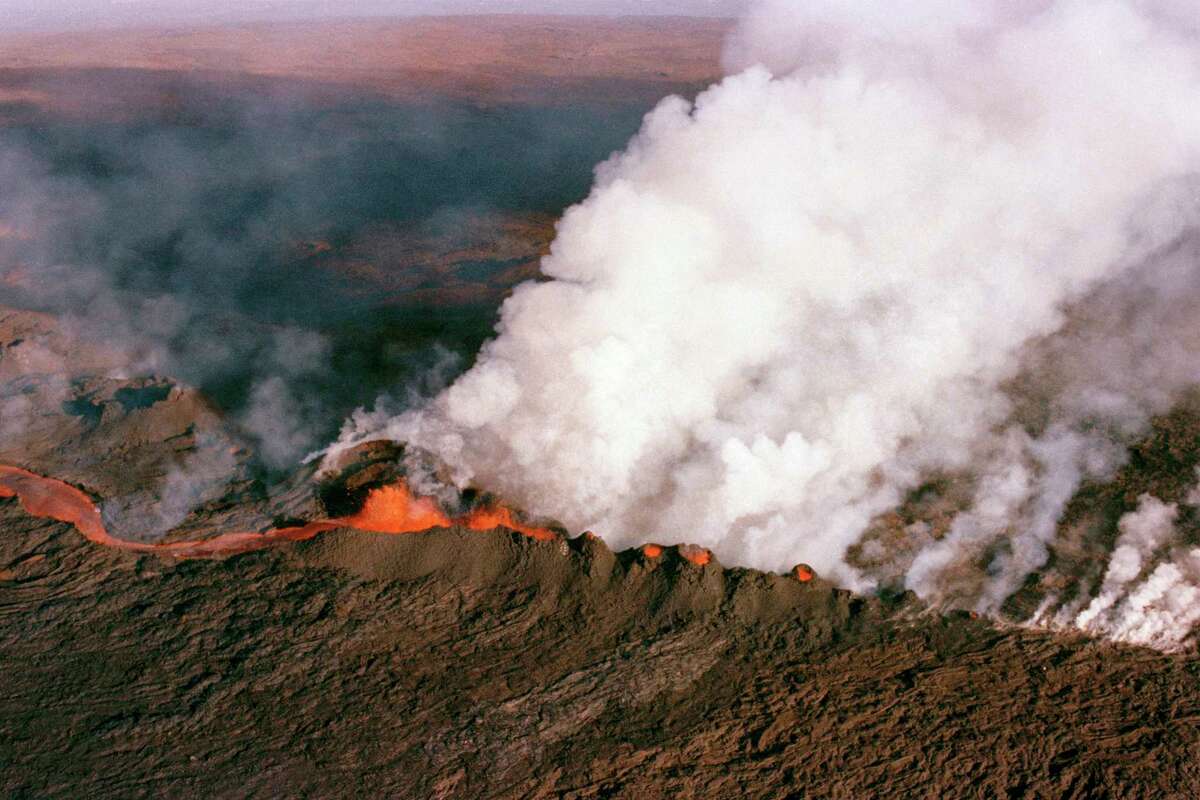
Hawaii’s Mauna Loa erupts for first time in nearly four decades
Nov. 28, 6:38 a.m.
Mauna Loa on the Big Island of Hawaii erupted for the first time since 1984 on Sunday night, spewing a massive cloud of ash and debris. The volcano’s lava flow is contained within the summit and as of Monday morning there continued to be no threat to nearby communities, the U.S. Geological Survey said.
Mauna Loa is the world’s most active volcano and has erupted 33 times since 1843, the first time an eruption was documented, according to the USGS. In 1984, lava flows were within 4.5 miles of Hilo, the largest community on the Big Island with a population of 44,000 people.
The National Oceanic and Atmospheric Administration shared satellite imagery on Twitter showing the heat and sulfur dioxide released from Mauna Loa’s summer caldera. The National Weather Service issued an ashfall advisory in effect through Monday morning, warning that up to a quarter inch of ash could accumulate around portions of the Big Island.
Around 11:30 p.m. HST last night, @NOAA's #GOESWest ?️ captured the eruption of Hawaii's #MaunaLoa volcano, inside @Volcanoes_NPS.
— NOAA Satellites (@NOAASatellites) November 28, 2022
This imagery shows the heat signature and the sulfur dioxide released from the #volcano's summit caldera, Moku‘āweoweo. pic.twitter.com/gHEG63rbLb
Scientists have recently been on alert and watching the volcano closely since earthquakes began rattling the volcano’s summit in September. Mauna Loa’s summit, cabins and high-elevation areas have been closed due to increased seismicity since Oct. 5.
Sunday’s eruption was first reported at 11:30 p.m. local time within Mokuaweoweo, the summit caldera of the volcano that’s within Hawaii Volcanoes National Park.
The USGS advised residents in the area of the volcano to review eruption preparations.
“Based on past events, the early stages of a Mauna Loa eruption can be very dynamic and the location and advance of lava flows can change rapidly,” the USGS said.
How long the volcano erupts and whether it could cause lava to flow to populated areas of the island is impossible to predict, said Miel Corbett, a USGS spokesperson.
“But I can tell you, we’re in constant communication right now with Hawaii Civil Defense, and they’re providing updates to community members,” she said.
The Associated Press contributed to this report.